| Author |
Lamb, George |
| Author of introduction, etc. |
McGlenen, Edward W. (Edward Webster), 1855-1930 |
| LoC No. |
07026247
|
| Title |
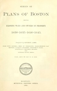
Series of plans of Boston showing existing ways and owners of property 1630-1635-1640-1645
|
| Original Publication |
Boston, MA: Municipal printing office, 1905.
|
| Credits |
Bob Taylor and the Online Distributed Proofreading Team at https://www.pgdp.net (This file was produced from images generously made available by The Internet Archive)
|
| Summary |
"Series of plans of Boston showing existing ways and owners of property…" by George Lamb is a historical account written in the early 20th century. The book compiles a series of detailed plans depicting the growth of Boston from its initial settlement in the early 17th century up to 1645. It serves as a significant record of the land ownership, geographical layout, and development of the town through its formative years. The content of the book includes maps and plans that illustrate property owners in Boston during the years 1630, 1635, 1640, and 1645. Each plan is meticulously detailed, showing the allotments of land based on various records such as town records and deeds, highlighting prominent figures like John Winthrop and Robert Harding. The text provides insights into the evolution of the town's layout, including street names and notable locations such as the First Church and burial grounds, while also noting the limitations and inaccuracies of the records, thereby enriching the historical context of early Boston and its community. (This is an automatically generated summary.)
|
| Language |
English |
| LoC Class |
F001: United States local history: New England
|
| Subject |
Real property -- Massachusetts -- Boston
|
| Subject |
Boston (Mass.) -- Maps
|
| Category |
Text |
| EBook-No. |
71790 |
| Release Date |
Oct 3, 2023 |
| Most Recently Updated |
Oct 6, 2023 |
| Copyright Status |
Public domain in the USA. |
| Downloads |
57 downloads in the last 30 days. |
|
Project Gutenberg eBooks are always free!
|

