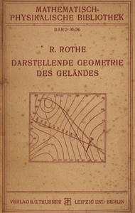
Darstellende Geometrie des Geländes by Rudolf Rothe
Read now or download (free!)
| Choose how to read this book | Url | Size | ||||
|---|---|---|---|---|---|---|
| Read online (web) | https://www.gutenberg.org/ebooks/58148.html.images | 298 kB | ||||
| EPUB3 (E-readers incl. Send-to-Kindle) | https://www.gutenberg.org/ebooks/58148.epub3.images | 1.9 MB | ||||
| EPUB (older E-readers) | https://www.gutenberg.org/ebooks/58148.epub.images | 1.9 MB | ||||
| EPUB (no images, older E-readers) | https://www.gutenberg.org/ebooks/58148.epub.noimages | 168 kB | ||||
| Kindle | https://www.gutenberg.org/ebooks/58148.kf8.images | 2.0 MB | ||||
| older Kindles | https://www.gutenberg.org/ebooks/58148.kindle.images | 1.9 MB | ||||
| Plain Text UTF-8 | https://www.gutenberg.org/ebooks/58148.txt.utf-8 | 210 kB | ||||
| Download HTML (zip) | https://www.gutenberg.org/cache/epub/58148/pg58148-h.zip | 1.8 MB | ||||
| There may be more files related to this item. | ||||||
Similar Books
About this eBook
| Author | Rothe, Rudolf, 1873-1942 |
|---|---|
| LoC No. | 25000174 |
| Title |
Darstellende Geometrie des Geländes und verwandte Anwendungen der Methode der kotierten Projektionen |
| Note | Reading ease score: 61.6 (8th & 9th grade). Neither easy nor difficult to read. |
| Credits |
Produced by The Online Distributed Proofreading Team at http://www.pgdp.net |
| Summary | "Darstellende Geometrie des Geländes" by Rudolf Rothe is a scientific publication written in the early 20th century. This work focuses on the graphical representation of topographical surfaces using the method of "kotierten Projektionen," which allows the reader to understand complex geographical shapes through mathematical principles and drawings. It is designed for those with an interest in applied geometry, particularly in fields such as surveying, geography, civil engineering, and geology. The opening of the text introduces the purpose and methodology behind the book's content, emphasizing how maps effectively portray terrains while addressing height differences. It discusses the importance of height lines or "Schichtlinien" that indicate points of equal elevation and how these can be applied to solve practical problems in topography and surveying. Furthermore, Rothe highlights the ease of understanding these concepts, suggesting that only basic geometric knowledge is required to engage with the material and practical applications presented throughout the work. (This is an automatically generated summary.) |
| Language | German |
| LoC Class | TA: Technology: Engineering and Civil engineering |
| Subject | Topographical surveying |
| Subject | Map projection |
| Subject | Geometry, Descriptive |
| Category | Text |
| EBook-No. | 58148 |
| Release Date | Oct 21, 2018 |
| Copyright Status | Public domain in the USA. |
| Downloads | 123 downloads in the last 30 days. |
| Project Gutenberg eBooks are always free! | |

